news
NBC Universal
Paramedic sentenced to 4 years of probation for role in Elijah McClain's death
The Telegraph
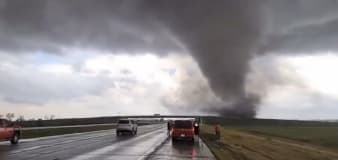
Watch: Storm chaser captures tornado tearing across Nebraska highway
NBC Universal
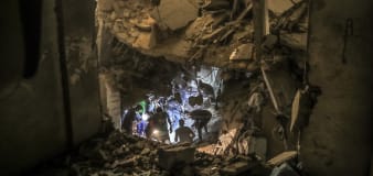
Investigation reveals Israel carried out strikes on Gaza areas it said were safe
NBC Universal
Columbia University protest at a stalemate as students remain camped on lawn
USA TODAY
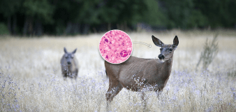
CDC: Deer meat didn't cause hunters' deaths; concerns about chronic wasting disease remain
Advertisement


Stay informed and up-to-date with your local news, breaking news events, global events, savings events, solar eclipse news, and in-depth coverage on a wide range of topics. From politics and technology to entertainment and science, we bring you the latest news from around the world.


