news
Reuters
Turkey says ending Israel's occupation of Palestinian territories is 'first priority'
The Telegraph
Israel’s attack on Iran 'took out' Russian-made air defense system: Reports
ABC News
USC cancels all commencement speakers after canceled valedictorian speech
CNN
San Francisco sues Oakland to stop it from changing the name of its airport
Associated Press
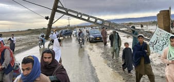
Pakistani province issues flood alert and warns of heavy loss of life due to glacial melting
Advertisement


Stay informed and up-to-date with your local news, breaking news events, global events, savings events, solar eclipse news, and in-depth coverage on a wide range of topics. From politics and technology to entertainment and science, we bring you the latest news from around the world.


