news
ABC News
1 man dead, 3 injured after men on scooters open fire on corner in the Bronx: Police
CNN
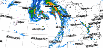
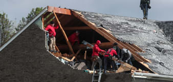
Powerful storms fire up in the Midwest with large hail and tornadoes
CBS News
Remains identified as 2 missing Kansas women at center of murder case
CBS News
Elephant named Viola escapes from circus, takes walk through Montana town
CNN
NASA says it expected space station garbage to burn up. The debris smashed into a Florida home instead
Advertisement


Stay informed and up-to-date with your local news, breaking news events, global events, savings events, solar eclipse news, and in-depth coverage on a wide range of topics. From politics and technology to entertainment and science, we bring you the latest news from around the world.


